Arikok National Park covers a fifth of Aruba — 34 square kilometers of cactus desert, dry riverbeds, and a windward coast the trade winds pound all day. It became a national park in 2000, and it holds the island's highest point, its best caves, and the ruins of a gold mine that closed in 1916. Most visitors see it from a jeep window. Hikers get the rest.
The trails here are short by continental standards — nothing exceeds 7.5 km — but they pass through lava rock, quartz-diorite boulders, and limestone terraces in a single morning, ending at turtle beaches and cliff-edge viewpoints. This guide compares all four official hikes, explains how to reach the Natural Pool on foot, and covers the costs, hours, and heat management that decide whether your hike is a highlight or a slog.
Why Hike in Arikok National Park?
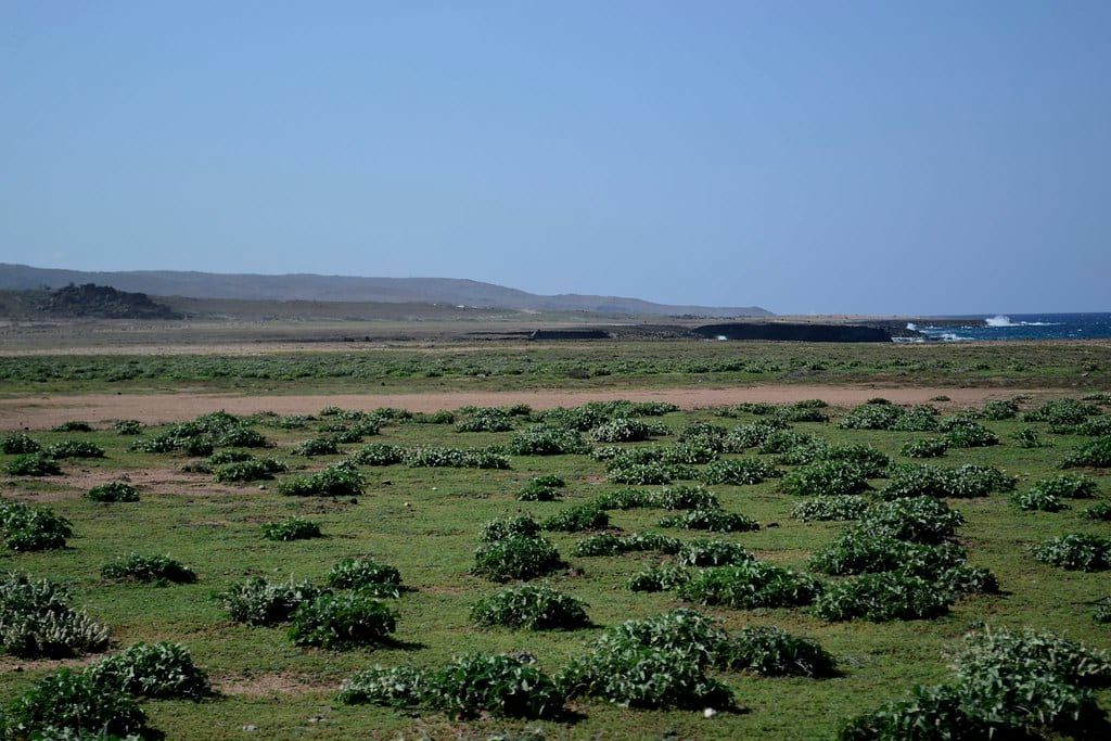
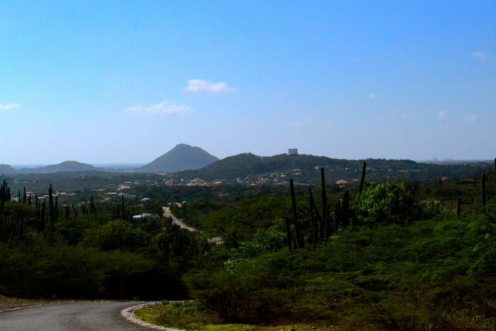
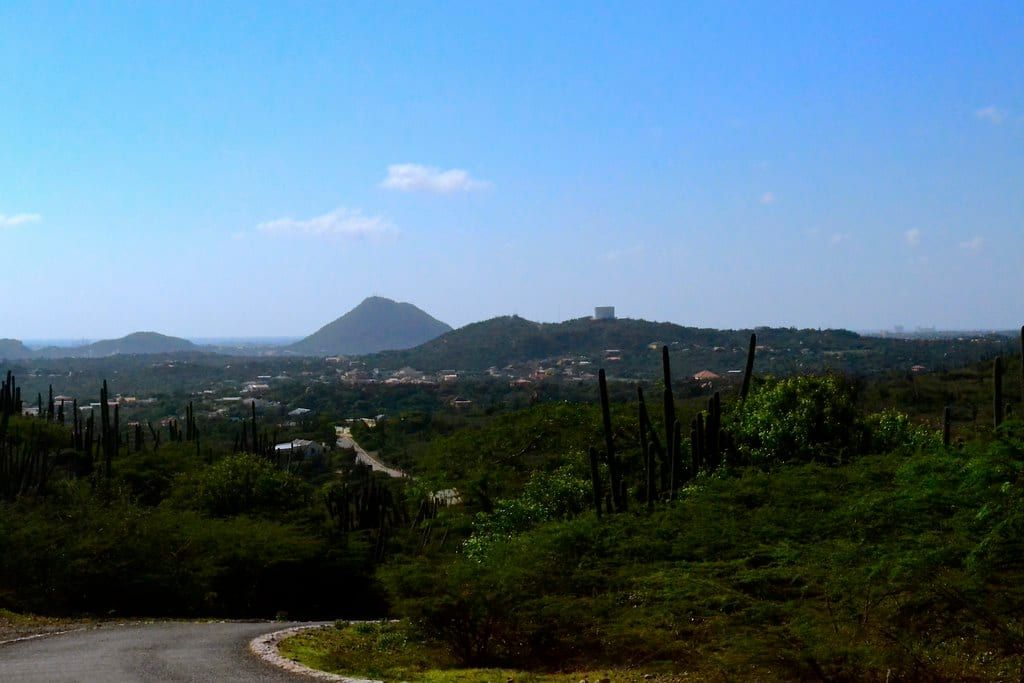
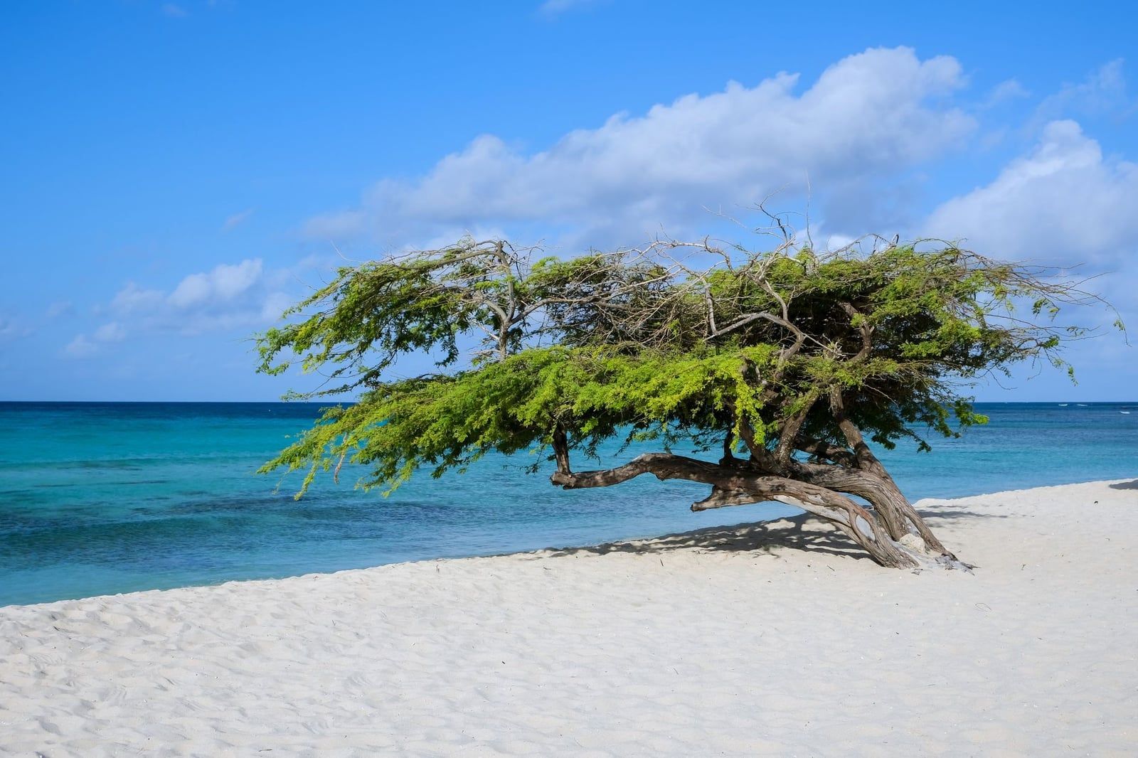
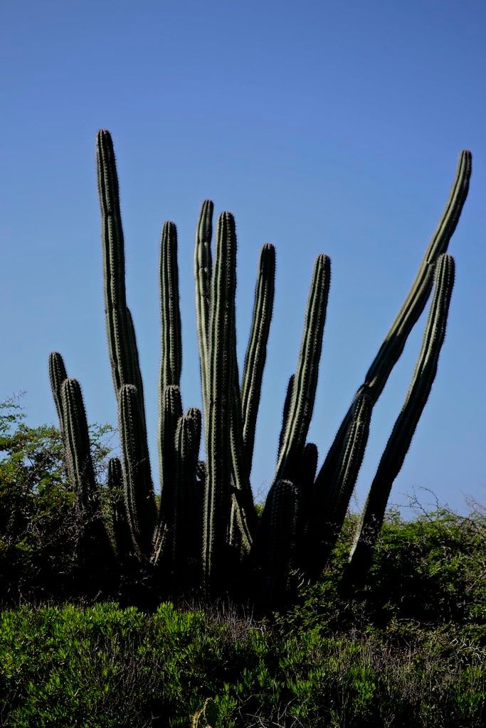
Arikok is a Caribbean oddity. Instead of rainforest, you get candelabra cacti, wind-shaped divi-divi trees, and hills of dark volcanic rock running down to a coast where waves explode against limestone cliffs. The park spans 7,907 acres — about 20% of Aruba — and three geological formations meet inside it: the Aruba Lava Formation, quartz diorite cut by the gold-bearing veins that made mining profitable, and young limestone terraces along the shore. If you want the fuller story of the park, from its Arawak rock art to its mining bust, the trails are where you actually walk through it.
Hiking here doesn't mean forest climbs. Paths run over sandy flats, along dry riverbeds called roois, and across bare rock marked with painted dashes. Shade is nearly nonexistent. What you get in exchange is a density of sights — pictographs, an adobe homestead, mine shafts, turtle-nesting coves — packed into routes you can finish before lunch.
The park is also quiet in a way Aruba's hotel strip never is. Tour groups cluster at the caves and the Natural Pool by mid-morning; on the longer trails you'll share the route with goats, lizards, and nobody else.
Know Before You Go: Passes, Hours, and Getting There
Entry costs $22 per adult as a conservation day-pass, sold at the San Fuego and Vader Piet entrances — no advance booking needed for a standard visit. Children under 17 enter free, and residents of Aruba, Bonaire, and Curaçao get a discount with a local ID. Ignore the $11 figure still printed on most blog guides; that price is years out of date. Current opening hours and entry fees come straight from the Aruba Conservation Foundation.
Hours matter more here than at most parks. San Fuego (the main entrance and visitor center) runs 8:00am–3:30pm daily; Vader Piet opens 8:30am and closes 3:00pm. Some listings still show 8am–4pm, but the park authority's posted closings are earlier, and ranger tours and cave visits wind down before them. Start hiking at 7 or 8am anyway — that's about heat, not just closing times.
Getting there takes about 30 minutes by taxi from the Eagle Beach hotel zone (roughly $30 from Noord — agree on the fare first, cabs are unmetered) or under 40 minutes in a rental from the Noord area via Route 4 to the San Fuego entrance. There's no public bus to the park, so without a car your options are a taxi, a rental, or a guided tour with hotel pick-up. Full directions and transport options are worth checking before you commit.
Vehicle rules surprise people. A regular 2WD rental handles the paved and main gravel roads to the caves and viewpoints — though dozens of low rocky gullies cross even the main road, and the in-park speed limit is 20 km/h. The track to the Natural Pool is different: it genuinely requires a 4x4, and standard rental insurance usually excludes damage on unpaved park roads. Buy off-road coverage or skip the track entirely — hiking it is covered below.
The Best Hiking Trails in Arikok National Park
The Aruba Conservation Foundation lists four official hikes, each with a suggested morning start time. Two are easy, two are hard, and together they cover nearly everything the park protects. Here they are — hardest decisions first: which one is yours.
Cunucu Arikok: the best first hike
This 5 km (3.1 mi) loop is the park's introduction, rated easy and usually walked in about 2 hours at a relaxed pace. The suggested start is 8am. It passes red-brown Caquetío pictographs on dolerite boulders, a restored adobe farmhouse — a cas di torto from the Arie Kok plantation that gave the park its name — and a wild garden with labeled native plants. First-timers should do this one; it packs more per kilometer than any other trail.
Miralamar: gold-mine ruins in an hour and a half
At just 2 km (1.2 mi) and rated easy, Miralamar is the shortest option, with a trailhead just uphill from the visitor center. It climbs to the overgrown ruins of the Miralamar Gold Mine, abandoned in 1916, and the walk out to the trail's viewpoint shows both coasts of the island at once — the calm leeward side and the rough windward side. Short on time or energy? This is your trail. It also marks the start of a much longer route, covered below.
Rooi Tambu to Dos Playa: the hard one
The park's toughest official hike runs 7.5 km (4.6 mi) and takes about 3.5 hours, with a suggested 7am start. It follows Rooi Tambu, the island's largest dry riverbed, down to Dos Playa — two wild coves that are among Aruba's most important sea-turtle nesting beaches, with leatherbacks coming ashore from March to September. The surf is powerful here; this is a beach for watching, not swimming. The riverbed terrain is rocky and exposed the whole way, which is why boots and long trousers are worth the extra heat.
Jamanota Hill: Aruba's roof
A 4.8 km (2.9 mi) route rated hard, Jamanota climbs for about 2 hours to a sub-top of Seroe Jamanota — at 188 m (617 ft), the highest point in Aruba — with a panorama over the island's southern half. The trail passes the branch to the Miralamar ruins en route. It's the pick if you want the single best view in the park and a workout to earn it.
The land-to-sea extension
Long-distance hikers can extend the Miralamar/Rooi Taki area into a land-to-sea route: continuing past the park boundary through Frenchman's Pass to the Spanish Lagoon salina and ending at Mangel Halto beach among the mangroves. It's a serious commitment with one logistical catch — you finish far from where you started. You either station a second car at the end or turn back halfway. Solo walkers without shuttle support should treat Frenchman's Pass as the turnaround.
| Trail | Distance | Duration | Difficulty | Suggested start |
|---|---|---|---|---|
| Cunucu Arikok | 5 km / 3.1 mi | 1.5–2 hr | Easy | 8:00am |
| Miralamar | 2 km / 1.2 mi | 1.5 hr | Easy | Morning |
| Rooi Tambu–Dos Playa | 7.5 km / 4.6 mi | 3.5 hr | Hard | 7:00am |
| Jamanota Hill | 4.8 km / 2.9 mi | 2 hr | Hard | Morning |
So which one? First visit, any fitness level: Cunucu Arikok. One morning only and you like ruins: Miralamar. Fit and want the coast: Rooi Tambu, booked as a ranger hike if the riverbed navigation worries you. Fit and want the view: Jamanota.
Hiking to Conchi Natural Pool Without a 4x4
Yes, you can reach Conchi on foot — several guides still claim the pool is only reachable by 4WD, and that's simply wrong. Walking in costs you nothing beyond the $22 pass and some sweat, and you skip the washboard track that rental insurers won't cover anyway. Our full natural pool guide covers the details; here are the two walking routes.
Route one starts at the San Fuego visitor center and covers about 3.9 miles round trip, passing Sero Arikok on the way. Rangers lead this as a half-day guided hike that often pairs the pool with Daimari. It's the version to choose if you want interpretation along with the mileage.
Route two is shorter and gentler: drive about 7 minutes from the visitor center to Daimari Beach, then walk roughly a mile to the pool across dirt trails, dunes, and volcanic rock, with the shoreline in view much of the way. This is the practical option for families and anyone hiking in the heat — less exposure, same destination.
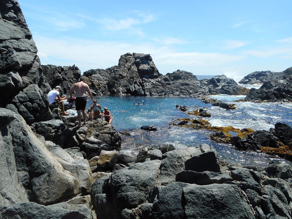
The pool itself is a rock-enclosed swim hole on the windward coast, reaching about 15 feet deep at its middle, with entry by ladder and rocks and a final descent on steep, narrow stairs. Swim only in calm seas — when swells rise, waves crash over the rim and rangers post advisories against entering. Conditions change fast, so check with rangers before you get in, and expect queues at the ladder midday when tour groups arrive. If walking in doesn't appeal, natural pool tours by licensed 4x4 are the alternative — just not ATVs, which are banned.
What You'll See on the Trail: Plants, Animals, and History
The park protects species found almost nowhere else, and a hike puts you among all of them in a couple of hours. Most of what follows will cross your path on Cunucu Arikok alone.
Plants that bite back
Cacti dominate: candelabra and Turk's cap types, the latter carrying an edible pink fruit, plus stands of aloe and wayaka trees adapted to months without rain. The one to learn before you go is bringamosa. Brush against it and your skin burns and itches for days, poison-ivy style; alcohol or the crushed seida plant are the traditional antidotes. Long trousers solve most of the problem.
Wildlife, including the snake
Birds come first here: the shoco, Aruba's national burrowing owl, nests in ground burrows, and bananaquits and hummingbirds work the cactus flowers. The kododo blauw — Aruba's blue whiptail lizard — scurries off every trailside rock, and more than 1,500 feral goats share the park with donkeys. As for the cascabel, Aruba's endangered island rattlesnake: roughly 250 adults survive island-wide, it's shy, and hikers almost never see one. Stay on marked trails and watch where you put your hands and feet.
History underfoot
The Caquetío people, on Aruba since around 2500 BC, left red pictographs in the park's caves and on trailside boulders dating to about the year 1000 — one bird painting became the park's logo. Settler history sits along the same paths: the Cunucu Arikok adobe homestead and the Miralamar mine buildings, abandoned when gold mining ended in 1916 after more than twenty quartz-gold veins were worked. Two caves pair naturally with any hike — Fontein, with Arawak drawings on its ceiling and gated, ranger-guided access, and Quadirikiri, where sunlight pours through holes in the roof. Skip the flashlights in Quadirikiri to protect the bats. Our guide to the caves covers both.
Desert Hiking Safety and What to Pack
Heat is the real hazard on these trails — the park is almost entirely shadeless, with highs around 87°F (31°C) year-round. Carry 2–3 liters of water per person on hiking days, more than you'd pack for a similar distance at home. Start by 8am at the latest, avoid the 11am–3pm window entirely, and turn back at any sign of dizziness. The Daimari-to-Conchi walk is the one coastal route where you can cool off mid-hike — but only in calm seas, and never at Dos Playa or Boca Prins, where swimming is prohibited due to currents.
Gear is simple. Trail shoes and shorts are fine on Cunucu and Miralamar; boots and long trousers earn their weight on Rooi Tambu and Jamanota, where cactus spines and thorny scrub line the route. Navigation is the other weak spot — some stretches are unmarked or faint, so grab a free trail map at the San Fuego visitor center before setting out, and note that toilets exist only at the visitor center and the park restaurant near Boca Prins.
The packing shortlist:
- 2–3 liters of water per person
- SPF 30+ sunscreen, reapplied after sweating
- Brimmed hat and sunglasses
- Sturdy closed shoes; boots on hard trails
- Long trousers on Rooi Tambu and Jamanota
- Water shoes for the Natural Pool
Timing: February through April are the driest, most comfortable months — March averages barely 15 mm of rain. October to January is the wet season, when dirt tracks turn muddy and rough, though rain falls in short bursts rather than all-day washouts. Any month works if you start early.
Guided Ranger Hikes vs. Hiking on Your Own
A ranger-led Nature Experience hike costs $25 per person on top of your pass, runs in groups capped at 10, and can last up to five hours depending on the route. All four official trails are offered. Book at least a day ahead by emailing the park foundation at [email protected] — older guides claiming ranger walks are free are years out of date. Each route has a set morning start time, which conveniently matches the heat advice.
When does a guide earn the $25? On Cunucu Arikok, easily — the trail's pictographs, plants, and plantation history mean little without interpretation, and rangers know where everything is. On Rooi Tambu and Jamanota, a guide helps with riverbed navigation and pacing on the two routes rated hard. Miralamar is the one where you can confidently go solo: it's short, starts at the visitor center, and the ruins are unmissable.
Confident hikers can self-guide all the easy options — free maps at the visitor center make the loops straightforward — and the Daimari–Conchi coastal path works fine independently if you check sea conditions first. A third route splits the difference: commercial guided hiking tours with hotel pick-up, which handle the logistics you'd otherwise arrange by taxi and map.
Sample Arikok Hiking Plans (Half-Day to Full-Day)
Three ready-made plans, each worked out against the park's real clock — an 8am opening and a 3:30pm close at San Fuego. Pick the one that matches your legs and your schedule.
Relaxed half-day: Cunucu plus the caves
Start the Cunucu Arikok loop at 8am, finishing near 10am. Drive the gravel road to Quadirikiri and Fontein for a ranger-led cave walk before the tour groups arrive, then loop back past the Boca Prins dunes. You're out before 1pm with the afternoon free — and with the visitor center closing at 3:30pm, you've lost nothing by leaving early.
Active half-day: Daimari to Conchi
Drive to Daimari Beach by 8am and walk the roughly 1-mile coastal path to the Natural Pool. Swim if the sea is calm and rangers allow it, then walk back before the midday heat and the tour-queue peak. You'll be back at your car by early afternoon, with a swim under your belt that jeep tourists waited in line for.
Full-day: Rooi Tambu, Dos Playa, and the caves
The 7am start gets you down the riverbed to Dos Playa with the morning still cool. Watch for turtle tracks in the sand from March to September, then return along the gully — or arrange the ranger-led version, which handles the timing. Afterward, fit legs can add the Jamanota Hill climb for the island's best panorama, and everyone should add a cave stop on the way out. One caveat on sequencing: caves wind down before the gates do, so save the beach and viewpoints for last, not the caves.
Whichever plan you build, the arithmetic is the same: pass bought by 8am, hiking done by noon, caves and viewpoints filling whatever's left of a park day that ends at 3:30pm sharp.
Frequently asked questions
Can you hike to the Natural Pool (Conchi) in Arikok without a 4x4?
Yes. Hike from the San Fuego visitor center (about 3.9 miles round trip past Sero Arikok) or take the shorter, gentler coastal path from Daimari Beach — roughly 1 mile each way across dirt trails, dunes, and volcanic rock. Either way you still need the $22 conservation pass. If you'd rather not walk, licensed 4x4 jeep tours reach it; ATVs and UTVs are banned in the park.
How much does it cost to enter Arikok National Park?
$22 USD per adult for a conservation day-pass, sold at the San Fuego and Vader Piet entrances. Children under 17 enter free, and residents of Aruba, Bonaire, and Curaçao get a discount with local ID. Many older guides still quote $11 — that price is long gone.
What are the best hiking trails in Arikok National Park?
The park foundation lists four: Cunucu Arikok (5 km, 1.5 hr, easy — pictographs and the adobe farmhouse), Miralamar (2 km, 1.5 hr, easy — gold-mine ruins), Rooi Tambu to Dos Playa (7.5 km, 3.5 hr, hard — dry riverbed to a turtle-nesting beach), and Jamanota Hill (4.8 km, 2 hr, hard — Aruba's highest point at 188 m).
Are guided hikes available in Arikok, and what do they cost?
Yes — ranger-led hikes on all four official trails cost $25 per person, are capped at 10 participants, and can run up to five hours. Reserve at least a day ahead with the Aruba Conservation Foundation at [email protected].
When should I start my hike, and what are the park's hours?
San Fuego visitor center runs 8:00am–3:30pm; the Vader Piet entrance runs 8:30am–3:00pm. Start hiking between 7 and 8am — the hard trails carry a suggested 7am start, and both closings arrive earlier than most listings claim.
What should I bring for a hike in Arikok?
At least 2–3 liters of water per person for a hiking day, SPF 30+ sunscreen, a brimmed hat, sunglasses, and sturdy closed shoes. Add boots and long trousers on Rooi Tambu and Jamanota, and water shoes if you're swimming at the Natural Pool.
Are there snakes or dangerous plants in Arikok?
One and one. The endangered Aruba Island rattlesnake (cascabel) lives here — only about 250 adults are estimated island-wide, and it's shy — and the bringamosa plant causes a poison-ivy-like burn lasting days. Stay on marked trails and don't brush through scrub.
Can you swim during an Arikok hike?
Yes, with conditions. The Conchi Natural Pool is safe to swim only when the sea is calm — never in rough surf. Rooi Tambu ends at Dos Playa, a leatherback nesting beach from March to September, but its currents are strong and swimming there is discouraged; watch the turtles from the sand instead.