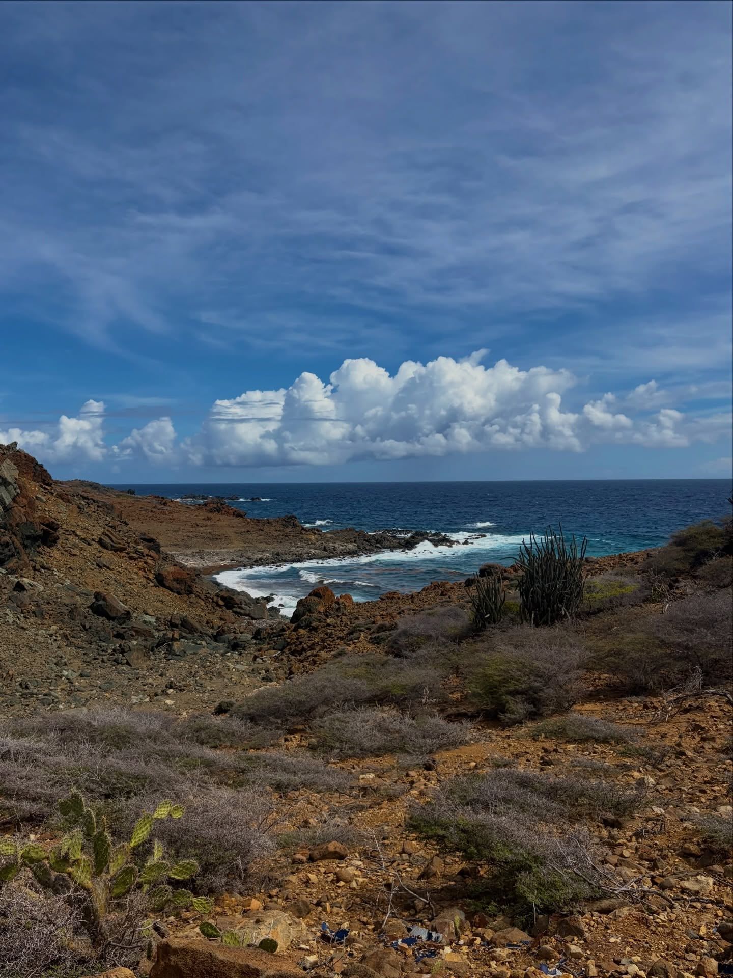
Arikok National Park protects 34 square kilometers of Aruba's wild northeast coast — a fifth of the entire island — where limestone caves hold Arawak rock art, trade winds pile up dunes at Boca Prins, and the island's highest point rises above a desert of cacti and lava rock.
Arikok National Park covers roughly 34 square kilometers of Aruba's northeastern coast — about a fifth of the whole island — which makes it one of the largest protected areas in the Dutch Caribbean. Most visitors come expecting a beach island and find a desert instead: cacti, wind-shaped divi-divi trees, volcanic rock and limestone terraces running down to a coast where the surf hits hard. Two entrances serve the park, San Fuego and Vader Piet, and a day-pass costs USD 22.
The park exists mostly to protect what's left of Aruba's native plants and animals, and several of them live here and almost nowhere else. The endangered cascabel, an Aruba Island rattlesnake, survives in the rocky terrain — watch where you put your hands. So do the kododo blauw whiptail lizard, the shoco burrowing owl and the prikichi parakeet, all with Papiamento names locals use daily. Green and leatherback turtles nest on the beaches at Dos Playa.
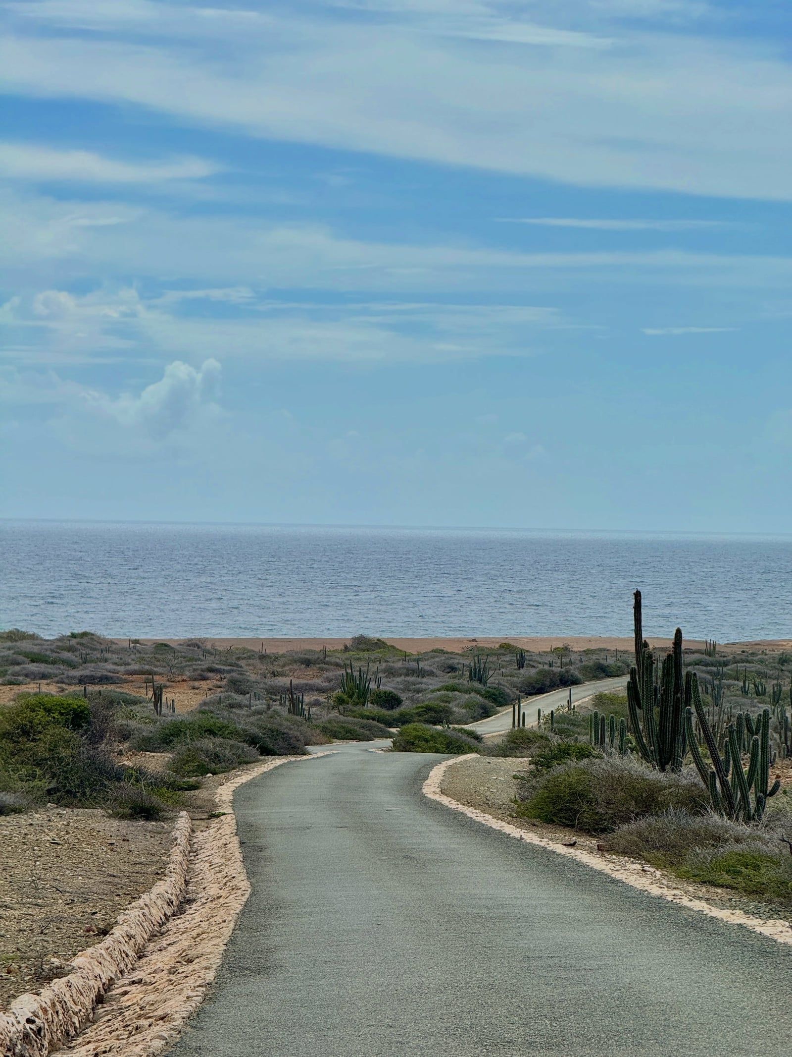
A typical visit runs half a day: a 4x4 circuit taking in the sunlit chambers of Quadirikiri Cave, the Arawak drawings in Fontein Cave, the blowing dunes at Boca Prins and a swim at Conchi, the Natural Pool, if the sea is calm. Add one of four guided ranger hikes (USD 25, capped at 10 people) and it's a full day. Go before 10 am — the interior heats up fast and jeep tours clog the cave parking lots by late morning. A regular 2WD rental handles the main roads fine; only the Conchi track demands a 4x4, a tour, a horse or a long walk.
Long before anyone wrote anything down, Arawak people were leaving their mark inside the park's caves. Red-brown pictographs still cover the ceiling of Fontein Cave — the only cave in Aruba with pre-Columbian rock drawings — and dolerite boulders near the old Cunucu Arikok farmhouse carry Arawak paintings too. One of those paintings is now the park's logo. Early European settlers later added their own marks alongside the Arawak drawings, and graffiti from more recent decades is why Fontein is now gated and ranger-guided only.
The park's name comes from the Arie Kok plantation, which farmed this dry corner of the island in the colonial era. Its cas di torto — a traditional adobe farmhouse built from mud, straw and cactus juice — has been restored and now anchors the Cunucu Arikok area, surrounded by a garden of labeled native plants and cactus hedges. Then came gold. More than 20 quartz-gold veins were mined in what is now park land, most of them at Miralamar, and the ruins of that operation still stand along the trail, overgrown and abandoned since mining ended in 1916.
Protecting the area was first discussed in the late 1960s, and a 1980 plan for the Arikok-Jamanota hills led to a small reserve around the restored farmhouse, called Cunucu Arikok. The idea kept growing. A Nature Protection Regulation arrived in 1995, the government approved a Nature and Landscape Structure Memorandum in 1996, and a commission drafted a management policy in 1997. In 2000 the park became official through a Ministerial Order — AB 2000 no. 59 — which remains the legal backbone for everything the park can and cannot enforce.
Three years later, in 2003, management passed to a foundation, first called Fundacion Parke Nacional Aruba and now the Aruba Conservation Foundation (ACF). That's the body that runs the two entrances, the ranger hikes, the restaurant and the reservations email today. The park holds IUCN Category II status, the international standard for a national park, and its rangers — the Nature Experience Rangers — lead the four bookable hikes that cover everything from the 188 m summit of Seroe Jamanota to the turtle beach at Dos Playa.
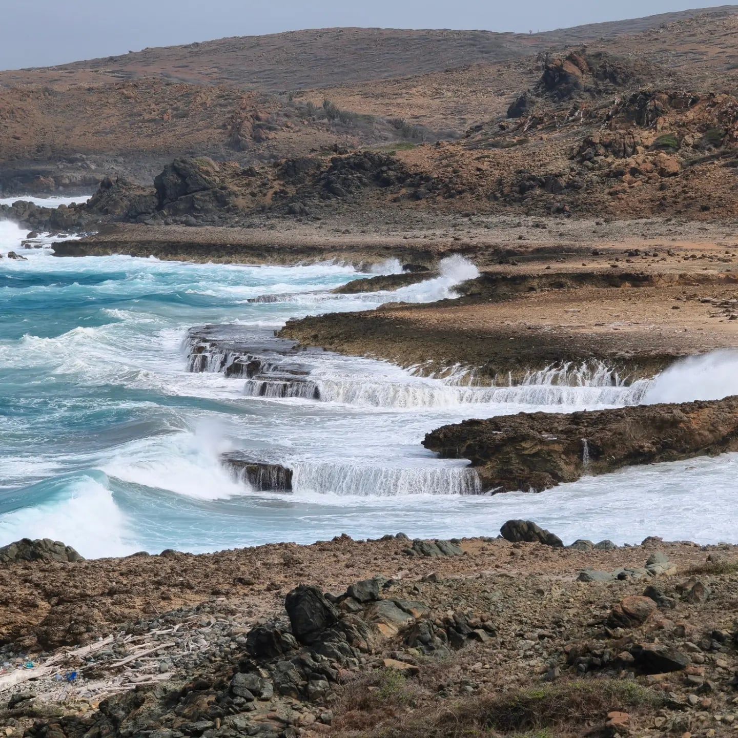
Three rock formations stack together inside the park, and each one shapes what you'll walk on. The oldest is the Aruba Lava Formation, dark volcanic rock that makes up the rough coastline around Conchi. Above it sits the Aruba Batholith — a huge body of quartz-diorite, laced with more than 20 quartz-gold veins, which is exactly why miners worked these hills for decades. The youngest layer is limestone, laid down as terraces along the coast, and it's in that soft limestone that the park's caves formed. Two hills define the skyline: Seroe Jamanota at 188 m, the highest point in Aruba, and the park's namesake Arikok hill at 185 m — just three meters apart.
The caves are the park's biggest draw. Quadirikiri extends about 100 feet through two large chambers, both lit by sunlight pouring through holes in the roof; hundreds of harmless bats roost in the darker sections, and a ranger walks you in from the parking lot, pointing out where to duck under stalactites. Fontein is smaller but holds the Arawak drawings. Bring closed shoes — cave floors are uneven and loose.
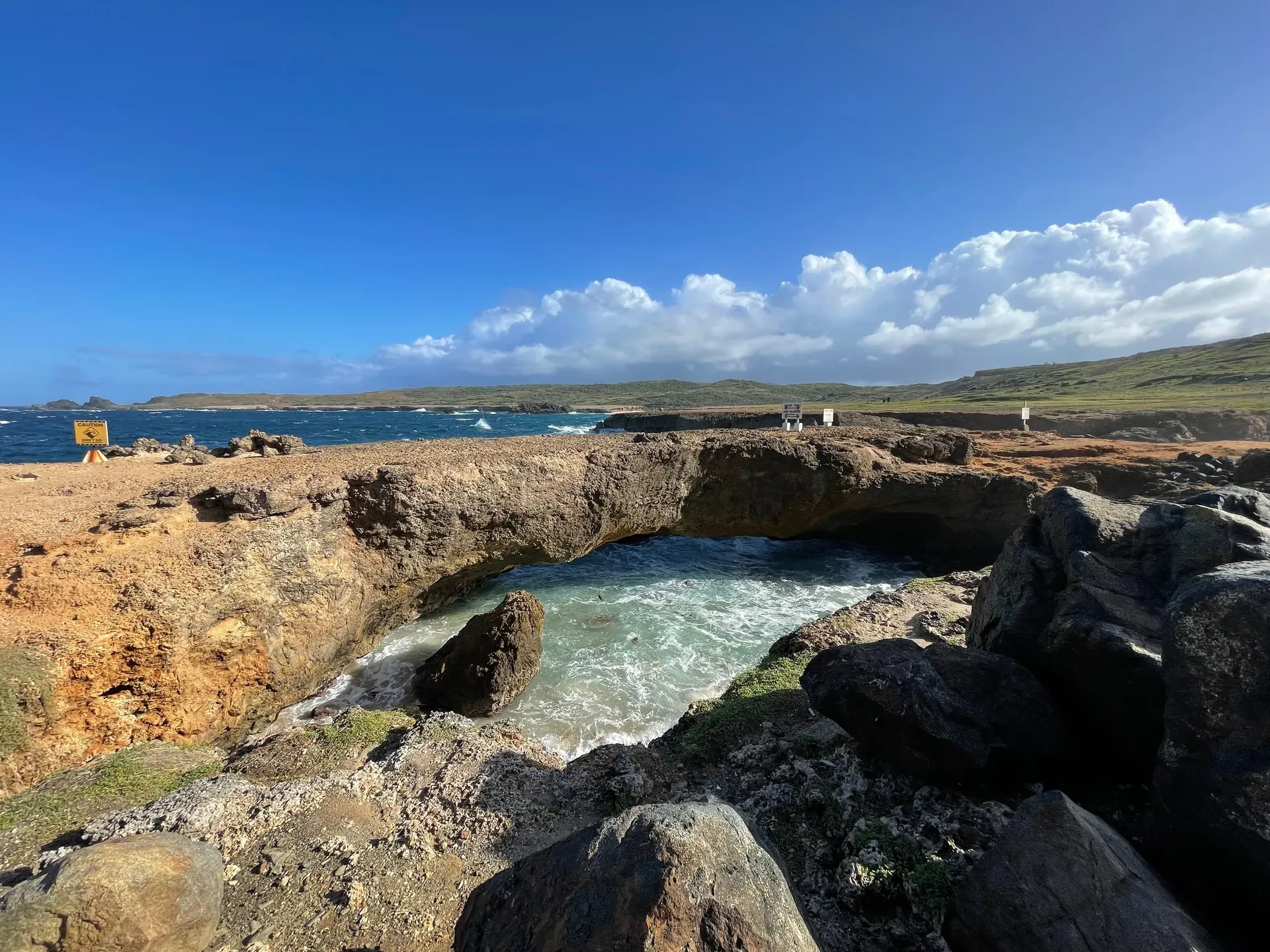
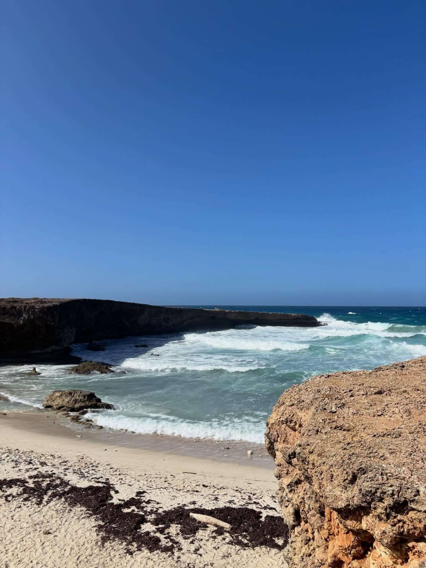
Away from the caves, constant northeastern trade winds do the sculpting. They pile sand into the moving dunes at Boca Prins, where a staircase drops to a cliff-backed beach (no swimming — strong currents), and they've bent every divi-divi tree into the same westward lean. Dry gullies called roois cut through the hills, and the park holds seven distinct vegetation types packed into its 34 km². At Dos Playa, two wild coves serve as Aruba's most important sea-turtle nesting beaches; the surf there is for watching, or expert surfing, and nothing in between. Conchi, the Natural Pool, sits in a volcanic rock bowl on the windward coast, reachable only by 4x4, horseback, tour or a long hike, then a set of steep, narrow stairs.
Arikok is where Aruba keeps the parts of itself that don't fit the resort postcard. The park's name comes from the Arie Kok plantation, its logo comes from an Arawak rock painting near Cunucu Arikok, and its caves hold the only pre-Columbian drawings on the island — a record of habitation that stretches back centuries before any European arrived. For a country of about 180 square kilometers, a park covering a fifth of that land is a statement about what the island wants to remain.
The local species carry local names — kododo blauw, shoco, prikichi, cascabel — and islanders use them the way they'd use any everyday word. Aruba put the shoco and the cascabel on stamps and in school lessons; the rattlesnake in particular survives almost nowhere else on earth, which gives a hike here an edge you won't feel on the hotel beaches. Restoring the cas di torto farmhouse at Cunucu Arikok was deliberate too: traditional adobe construction, with cactus hedges and stone walls, preserved in a working garden of native plants.
Day to day, the park belongs to the people who live here as much as to tourists. Residents of Aruba, Bonaire and Curaçao get a discounted entry with a local ID, the park restaurant between Boca Prins and Fontein Cave is a regular lunch stop, and the Aruba Conservation Foundation's rangers run school visits and the guided hikes. Independent travelers pair the park with Ayo's boulders, the Natural Bridge and the yellow Alto Vista Chapel on a single north-coast loop — the itinerary most Arubans would recommend to a visiting friend.
The cascabel (Crotalus unicolor) is one of the rarest rattlesnakes in the world and lives in the wild essentially only in Arikok and the rest of Aruba. It's endangered, so watch your step on the rocky trails.
Seroe Jamanota, at 188 m (617 ft), is the highest point in all of Aruba — and it sits inside the park. The namesake Arikok hill is just 3 m lower.
Quadirikiri Cave has two large chambers lit by holes in the roof, with hundreds of harmless bats roosting in the dark sections. You can visit without a flashlight during the day.
More than 20 quartz-gold veins were mined inside what is now the park, mostly at Miralamar. Mining ended in 1916, and the overgrown ruins still stand along the Miralamar trail.
The park's logo is based on an actual Arawak rock painting on a dolerite boulder near the Cunucu Arikok farmhouse. Fontein Cave holds the only pre-Columbian rock drawings in Aruba.
ATVs, UTVs and motorbikes are prohibited inside the park due to their impact on nature — a rule many visitors only learn at the gate. The speed limit for cars is 20 km/h.
Violating park rules — flying a drone, collecting rocks, stacking stones, driving off-road — can draw fines up to USD 100,000 under Ministerial Order AB 2000 no. 59.
Adults pay USD 22 for a conservation day-pass, sold at both the San Fuego and Vader Piet entrances. Children under 17 enter free, and residents of Aruba, Bonaire and Curaçao get a discount with a government-issued photo ID. Older articles quoting USD 11–15 are outdated. Guided ranger hikes cost an additional USD 25 per person.
The park is open daily. The San Fuego entrance and Visitor Center run 8:00 am–3:30 pm, and the Vader Piet entrance 8:30 am–3:00 pm. Some travel listings still show 8 am–4 pm, but the park authority's posted times close earlier. Arrive before mid-afternoon, since cave visits and ranger tours wind down before closing.
Not for everything. A regular 2WD rental can reach the main caves and viewpoints on the paved and well-maintained gravel roads. But the track to the Natural Pool (Conchi) requires a 4x4, a jeep tour, horseback or a multi-hour hike. ATVs, UTVs and motorbikes are banned inside the park entirely.
Yes, but only when the ocean is calm. Waves can crash over the surrounding rocks, conditions change quickly, and rangers post advisories against swimming when swells rise. Water shoes are strongly recommended, and access involves a short walk down steep, narrow stairs.
No. Swimming at Boca Prins is strictly prohibited because of strong currents and large rocks, and it's strongly discouraged at Dos Playa for the same reason. Treat these beaches as picnic, photo and turtle-watching spots, and save swimming for the calm west-coast beaches.
Plan half a day to a full day. A half-day (4–5 hour) circuit covers the Visitor Center, Quadirikiri and Fontein caves, the Boca Prins dunes and the Natural Pool by 4x4. Adding a guided hike — Jamanota Hill (2 hr), Rooi Tambu–Dos Playa (3.5 hr) or Cunucu Arikok (1.5 hr) — makes it a full day.
No. Dogs, cats and other domestic or exotic animals are prohibited under park rules. Violations fall under Ministerial Order AB 2000 no. 59, which carries fines of up to USD 100,000 for offenses like littering, collecting plants or animals, off-road driving and flying drones.
Day-passes are sold at both entrances — San Fuego and Vader Piet — so no advance booking is needed for a standard visit. Guided ranger hikes (USD 25 per person, max 10 people) should be reserved in advance by emailing [email protected].
Aruba sits outside the Caribbean hurricane belt, so the park is open year-round. October–January brings a brief rainy season — November averages about 3.8 in (98 mm) of rain — which can muddy the dirt tracks, while February–April are the driest months for hiking.
The park is named after the Arie Kok plantation and its hill, which rises 185 m (606 ft). The restored plantation farmhouse, a traditional adobe cas di torto, still stands at Cunucu Arikok inside the park, and an Arawak rock painting on a nearby boulder became the park's logo.
Browse verified tours with free cancellation and instant confirmation.
Find Tours